20th Century advancements in overhead surveillance dramatically altered human perception of the land. From above, our visual expanse is broadened, and our ability to map large areas of the surface was redefined by the aerial photomosaic. This tool combined multiple photographs to enable us to piece together a comprehensive view of formations beneath our feet.
The photomosaic represents advancement in the imaging of the landscape, but also speaks to the power structures in warfare and surveillance. It simplifies the surface into governable masses, where borders deny natural formations and instead mark how land is divided, claimed, and exploited for resources.

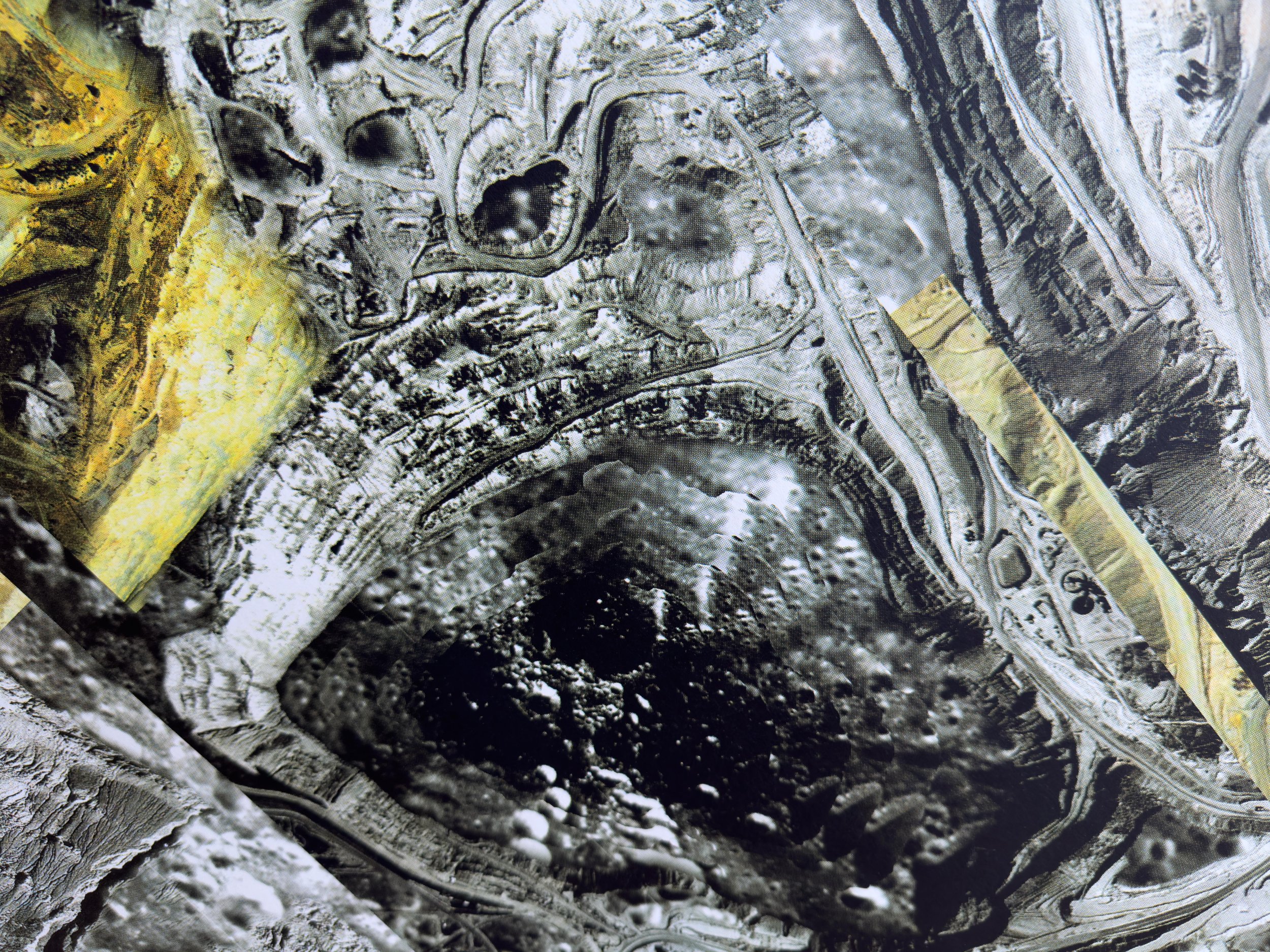
Photomosaic of abandoned mine, CMYK screen print on Heritage White, 83.8 by 114.3 cm, 2022
Through digital editing and printmaking, I play with the aesthetics of aerial photomosaics to embed these narratives of power and progression, which are inextricably tied to resource extraction. The experimental composition of this artwork takes a contemporary spin on the photomosaic to capture a visual expanse of territory and ownership.
I edit a selection of imagery: enlarging and overlapping elements of the land, stitching together distorted viewpoints. I manipulate the satellite perspective by altering colour information and embedding shadows to create a deceptively three-dimensional surface. Transferring my digital photomosaic into a large, screen-printed form materialises complex layers that both reveal and conceal the movements of the natural forces and degrading infrastructure at this disused open pit mine. It is in urgent need of assessing.
The land is glowing. Toxicity lurks.